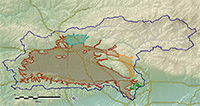
ULARA GROUNDWATER BASINS
THE SAN FERNANDO BASIN, the largest of the four basins, consists of 112,000 acres and comprises 91.2 percent of the total valley fill in ULARA. It is bounded on the east and northeast by the San Rafael Hills, Verdugo Mountains, and San Gabriel Mountains; on the north by the San Gabriel Mountains and the eroded south limb of the Little Tujunga Syncline which separates it from the Sylmar Basin; on the northwest and west by the Santa Susana Mountains and Simi Hills; and on the south by the Santa Monica Mountains. Read More
THE SYLMAR BASIN, in the northerly part of ULARA, is the second largest basin, and it consists of 5,600 acres and comprises 4.6 percent of the total valley fill. It is bounded on the north and east by the San Gabriel Mountains; on the west by a topographic divide in the valley fill between the Mission Hills and the San Gabriel Mountains; on the southwest by the Mission Hills; on the east by sedimentary rocks along the east bank of the Pacoima Wash; and on the south by the eroded south limb of the Little Tujunga Syncline.Read More
THE VERDUGO BASIN, north and east of the Verdugo Mountains, consists of 4,400 acres and comprises 3.6 percent of the total valley fill. It is bounded on the north by the San Gabriel Mountains; on the northwest by a groundwater divide, which separates it from the San Fernando Basin; on the east by a groundwater divide separating it from the Monk Hill Subarea of the Raymond Basin; on the southeast by the San Rafael Hills; and on the south and southwest by the Verdugo Mountains. Read More
THE EAGLE ROCK BASIN, the smallest of the four ULARA groundwater basins, lies in the southeast corner of ULARA. It consists of only 800 acres and comprises 0.6 percent of the total valley fill in ULARA. Read More
